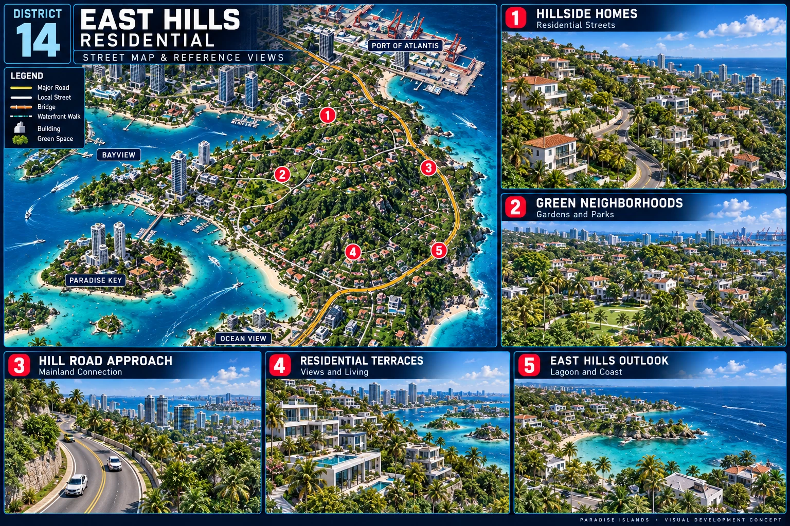
No scope-specific measured model view set is recorded. Shared regional links are context, not a completed district capture set.
Required five-view slots
clean-layout: missing
street-map: missing
verified-overhead: missing
southeast-aerial: missing
southwest-aerial: missing
Clean layout, street map and verified overhead
The first three required views share map extent, registration, geometry revision and units. Verified overhead means checked mesh projection, never a concept relabelled verified.
Scope-specific matched maps missing.
Streets
Scope-specific measured street atlas missing; regional links are context only.
Topography and shoreline
Detailed scope-specific terrain, shore treatment and sections remain incomplete. R07 candidate ground/water and W1 analytical section do not establish engineering, drainage or accepted-world elevations.
Coordinated capture requirements
Every scope uses the same fourteen requirements. All shots must identify the same native model revision and saved cameras, with clean companions. The older 0-target regional queue remains source history; it is not a completed capture set.
Required deliverable
State
Evidence needed
Clean metric overhead
Not evidenced
Model + camera + native scene/capture + comparison review
Overhead with streets, POI IDs, north and scale
Not evidenced
Model + camera + native scene/capture + comparison review
Northeast aerial
Not evidenced
Model + camera + native scene/capture + comparison review
Northwest aerial
Not evidenced
Model + camera + native scene/capture + comparison review
Southeast aerial
Not evidenced
Model + camera + native scene/capture + comparison review
Southwest aerial
Not evidenced
Model + camera + native scene/capture + comparison review
Ground-height arrival
Not evidenced
Model + camera + native scene/capture + comparison review
Ground-height street connection
Not evidenced
Model + camera + native scene/capture + comparison review
Bridge or cross-region approach
Not evidenced
Model + camera + native scene/capture + comparison review
Shoreline / bank treatment
Not evidenced
Model + camera + native scene/capture + comparison review
Terrain and elevation treatment
Not evidenced
Model + camera + native scene/capture + comparison review
Walk / drive / boat route review
Not evidenced
Model + camera + native scene/capture + comparison review
Empty companions for populated or traffic views
Not evidenced
Model + camera + native scene/capture + comparison review
Native scene, saved cameras and executed import evidence
Not evidenced
Model + camera + native scene/capture + comparison review
Geometry and downloads
Keep package dependencies together. A region package is not automatically registered to a district or the authoritative world.
No complete native foundation package for this exact scope is asserted by this desk. Available shared packages retain their named regional scope.
Open decisions and readiness
Gate
Current state
Evidence
published
pending live verification
Not recorded
reference-complete
blocked
Not recorded
test-import-ready
blocked
Not recorded
construction-ready
blocked
Not recorded
Controlling visual reference and scoped selection
not tested
Not recorded
Measured shared layout and geometry
not tested
Not recorded
Executed native-scene import
not tested
Not recorded
Complete coordinated capture set
not tested
Not recorded
Accepted world origin, orientation and datum
not tested
Not recorded
Measured collision, navigation and route acceptance
not tested
Not recorded
Reference completion checklist
clean-layout: missing — Scope-specific evidence is not yet complete.
street-map: missing — Scope-specific evidence is not yet complete.
verified-overhead: missing — Scope-specific evidence is not yet complete.
southeast-aerial: missing — Scope-specific evidence is not yet complete.
southwest-aerial: missing — Scope-specific evidence is not yet complete.
streets: missing — Scope-specific evidence is not yet complete.
topography-shoreline: missing — Scope-specific evidence is not yet complete.
reference-gallery: complete — Current source gallery is present with byte provenance; visual acceptance stays separate.
geometry-downloads: missing — Scope-specific evidence is not yet complete.
capture-plan: missing — Scope-specific evidence is not yet complete.
quik-handoff: missing — Scope-specific evidence is not yet complete.
Open: final layout selection; shared world frame/datum; current asset placement; detailed terrain and shoreline; actual native import; route/collision/navigation acceptance. Historical proxy warnings require current actor comparison before moving assets.
Quik start here
Read the exact master, source differences and current protocols. Preserve the existing Crown project and active branch.
Identify or author a measured package for this exact scope. Use linked regional packages only as explicit context; do not invent local placement from a concept image.
Record actual tool/version, import settings, units, axes, bounds, current world anchors and water datum. Static importer preflight is not engine execution.
Save the native scene and cameras, capture the required overhead/aerial/street/shore views and empty companions, then return measured routes and collision/navigation findings.
Publish a new communication record and the evidence. Request scoped design/world acceptance from the actual evidence; preserve the D03 construction pause.