West Coast · daytime composition

World atlas / West Coast / Production references

Northwest.
Reference library.

Ridge, coast and northern arrival. Browse the source context and the evidence required for a coordinated regional reference set.

West Coast · daytime composition · composition reference

Reference authority. Artwork establishes appearance; the R07 projections describe a proposed metric layout. Their cameras are separate. Matched finished aerials, native captures and detailed terrain remain open; the gallery does not grant construction acceptance.

4Source image references
0Metric geometry views
0POI appearance concepts
0 / 14Native capture requirements evidenced
01 / Visual sources

Reference image collection

Street life, buildings, coast and clean companions. Every image retains its source, original resolution and reference status.

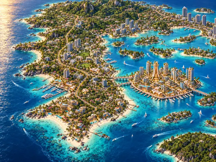
West Coast · daytime composition
atmosphere · visual reference

West Coast · daytime composition

Newer visual source. Appearance intent; not measured NW/SW geometry.

720 × 540 px · concept

Open full image · Download

Source, revision and evidence

ref-5

sha256:351c8ce7a692e51c3cbe6b257d50f78dbff5944aa392e84f25b74e9141fa99ec

Repository source

docs/southwest-prep/R01/visuals/reference-previews/WC-REF-005.webp

SHA-256 351c8ce7a692e51c3cbe6b257d50f78dbff5944aa392e84f25b74e9141fa99ec

Validation evidence

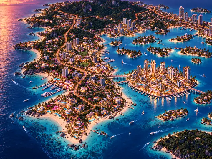
West Coast · twilight atmosphere
atmosphere · visual reference

West Coast · twilight atmosphere

Newer visual source. Appearance intent; not measured NW/SW geometry.

720 × 540 px · concept

Open full image · Download

Source, revision and evidence

ref-6

sha256:8b3201328f546ce8634f9cabc49e47359d2221b50d3f8966aed4eb26251962d4

Repository source

docs/southwest-prep/R01/visuals/reference-previews/WC-REF-006.webp

SHA-256 8b3201328f546ce8634f9cabc49e47359d2221b50d3f8966aed4eb26251962d4

Validation evidence

Source index · JSON

02 / One candidate model

Exact geometry reference views

Clean layout, street map, checked overhead and southeast/southwest aerial projections from the same R07 geometry hash. These are technical references; finished art is above.

Northwest model set is not issued.

The four source images establish context. A measured shared layout, saved cameras and scope-specific geometry exports are required before issuing these five views. Southwest geometry is available as neighboring context only.

Inspect Southwest geometry →
03 / View authority

Clean, labelled and checked maps

Choose the view that answers the question: composition, street naming or measured candidate geometry.

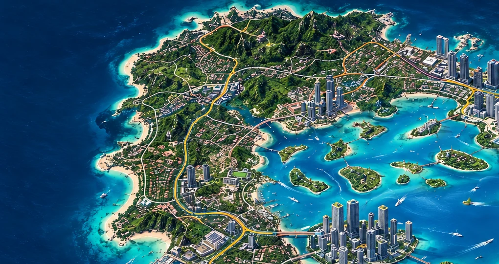
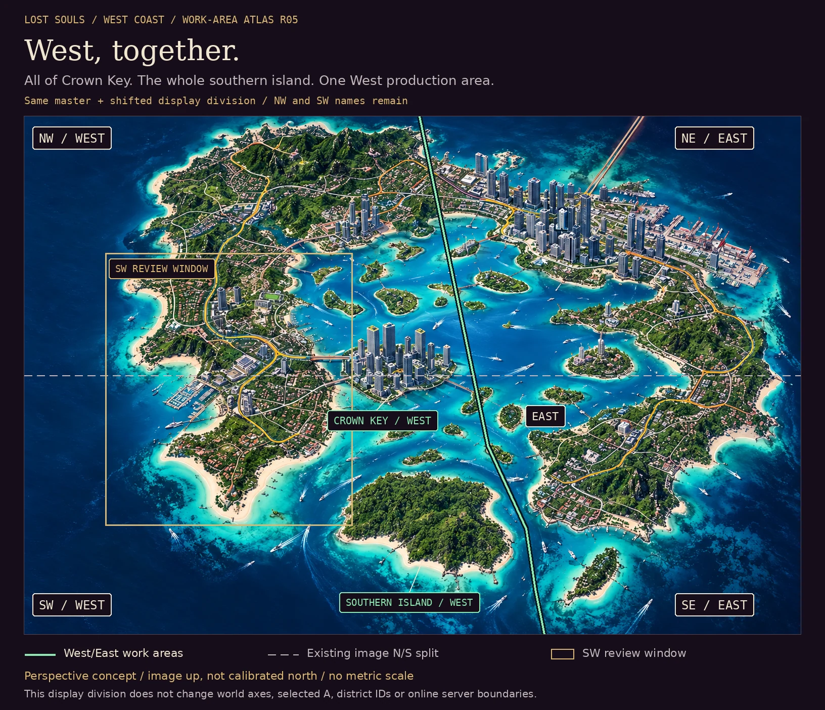
Open Northwest concept crop. Clean/labelled/verified metric companions require an authored Northwest model. Image up is not calibrated geographic north.

04 / Connected places

Street atlas and POI coverage

Keep proposed names, canonical corridor IDs and POI appearance separate until they are reconciled on the same model.

Northwest street names and parcel-linked POI references are not issued. Author the northern street atlas from the shared world frame before adding local names or camera coverage.

05 / Coast and grade

Topography and shoreline

Coastal appearance and technical elevation evidence have different roles. Both are needed for the development reference set.

The regional artwork contains ridge and coast context. It does not establish elevations, shore profiles, drainage or bathymetry. Northwest needs its own measured terrain model and captured treatments.

06 / Production coverage

Coordinated capture set

Fourteen roles describe the native capture handoff. The five deterministic geometry projections above are a separate, available reference set.

Open native coverage: clean and labelled overheads; NE/NW/SE/SW aerials; street arrival and street connection; shared approach; shoreline and terrain; route review; clean companions; saved native scene. Use the same model revision and recorded cameras throughout.

Inspect all 14 capture roles and evidence requirements
Capture roleRecorded stateEvidence needed
Clean metric overheadnot testedNative scene hash, model revision, saved camera, capture and comparison review.
Overhead with streets, POI IDs, north and scalenot testedNative scene hash, model revision, saved camera, capture and comparison review.
Northeast aerialnot testedNative scene hash, model revision, saved camera, capture and comparison review.
Northwest aerialnot testedNative scene hash, model revision, saved camera, capture and comparison review.
Southeast aerialnot testedNative scene hash, model revision, saved camera, capture and comparison review.
Southwest aerialnot testedNative scene hash, model revision, saved camera, capture and comparison review.
Ground-height arrivalnot testedNative scene hash, model revision, saved camera, capture and comparison review.
Ground-height street connectionnot testedNative scene hash, model revision, saved camera, capture and comparison review.
Bridge or cross-region approachnot testedNative scene hash, model revision, saved camera, capture and comparison review.
Shoreline / bank treatmentnot testedNative scene hash, model revision, saved camera, capture and comparison review.
Terrain and elevation treatmentnot testedNative scene hash, model revision, saved camera, capture and comparison review.
Walk / drive / boat route reviewnot testedNative scene hash, model revision, saved camera, capture and comparison review.
Empty companions for populated or traffic viewsnot testedNative scene hash, model revision, saved camera, capture and comparison review.
Native scene, saved cameras and executed import evidencenot testedNative scene hash, model revision, saved camera, capture and comparison review.

Finished imagery follows Spatial Imagery R01: controlling artwork + model/camera + neutral render + documented comparison. Attractive independent images do not become matched spatial views.

07 / Working package

Geometry and downloads

Four build-input groups follow the current District Protocol. Download the candidate package, keep both geometry JSON files together, and retain its proposed/test-only status.

Package groupAvailable scopeInputs and evidence
A. Design referencesavailable for visual review
northwest
original source index
B. Authored measured layoutblocked missing scope package
northwest
Not issued
C. Exact layout viewsblocked missing scope package
northwest
Not issued
D. Terrain and edgesblocked missing scope package
northwest
Not issued

Download package inventory · revisions, file hashes, compatible layout and open requirements

No Northwest native geometry package is issued. The context gallery and this desk’s return template are available; the Southwest package retains its neighboring regional scope.

08 / Review state

Open decisions and readiness

Published references remain distinct from a complete reference pack, an import test and accepted construction.

Reference completion remains blocked by the matched capture and terrain coverage. Final layout selection, accepted world frame/water datum and current asset placement are open. Unreal import, collision, navigation and route acceptance require measured returns.

Evidence gates and reference completion checklist
Readiness gateStateEvidence
publishedpending live verificationNo qualifying evidence recorded
reference-completeblockedNo qualifying evidence recorded
test-import-readyblockedNo qualifying evidence recorded
construction-readyblockedNo qualifying evidence recorded
Controlling visual reference and scoped selectionnot testedNo qualifying evidence recorded
Measured shared layout and geometrynot testedNo qualifying evidence recorded
Executed native-scene importnot testedNo qualifying evidence recorded
Complete coordinated capture setnot testedNo qualifying evidence recorded
Accepted world origin, orientation and datumnot testedNo qualifying evidence recorded
Measured collision, navigation and route acceptancenot testedNo qualifying evidence recorded
  • clean-layout · missing — Scope-specific evidence is not yet complete.
  • street-map · missing — Scope-specific evidence is not yet complete.
  • verified-overhead · missing — Scope-specific evidence is not yet complete.
  • southeast-aerial · missing — Scope-specific evidence is not yet complete.
  • southwest-aerial · missing — Scope-specific evidence is not yet complete.
  • streets · missing — Scope-specific evidence is not yet complete.
  • topography-shoreline · missing — Scope-specific evidence is not yet complete.
  • reference-gallery · complete — Current source gallery is present with byte provenance; visual acceptance stays separate.
  • geometry-downloads · missing — Scope-specific evidence is not yet complete.
  • capture-plan · missing — Scope-specific evidence is not yet complete.
  • quik-handoff · missing — Scope-specific evidence is not yet complete.
09 / Developer handoff

Quik, start here.

Use a fresh isolated scene. Preserve the current Crown project, accepted asset dimensions, active branch and District 3 pause.

  1. Read the controlling inputs.Review the visual masters, source differences, current protocols and Northwest context. Author a scope-specific metric foundation before claiming local captures.
  2. Import and measure.Record tool/version, units, axes, bounds, world anchors and water datum. Save the native scene and cameras. Never rescale Crown to fit a candidate region.
  3. Capture and return.Export the matched overheads, aerials, street and shore views with empty companions. Return comparisons, routes and collision/navigation findings in the scope template and communications lane.

Common process: Reference Standard R02 · Completion checklist · Spatial Imagery R01 · Building R05 / District R05

Reference image

Expanded reference image

Open original image ↗