
Southwest / R06 / geometry handoff
Inspect the geometry.
Build from the evidence.
A versioned JSON handoff for Quik, with a dimensioned connection specimen, preserved regional source traces and independent calculation evidence.
Ready for isolated local import and review; shared-world integration remains gated. The regional pixel-to-metre transform, shared water datum and final placements remain unresolved.
The Quik handoff
Start with the README and validator. Keep the import in a fresh test collection or isolated test level. The package does not authorize replacing the live district or changing Quik’s active scene.
All published files and SHA-256 evidence
| File | Bytes | SHA-256 |
|---|---|---|
| AI_START_HERE.md | 3703 | 4c622f65ec79b153d00608db426cbb352045c711a0a1deff0379dc926dd13c31 |
| ARTIFACT_MANIFEST.json | 3835 | 3741a2f507630f5bb24144a433f94f9477cdfedab21f0bec8b5cd82d9c5a344e |
| AXIS_FIXTURES.json | 1842 | a6b89409e87e8f46036ca471f787af2dd802f7661315589ee99c011e749f2f84 |
| CONNECTION_SPEC.json | 13430 | 3090c0ad66b800161b66bece47e0ead16ed9a81fdc881e3d7ad30ab420a28c3a |
| GENERATOR_CHOICES.json | 601 | 4929b94fa70a207fa1065341a03e5e953539be6a32b9477ea1ffe2d1279f1690 |
| GEOMETRY_HANDOFF.json | 1633749 | 70f1b36a2fe740ed8301ab09764760b7bf73464387dc383f58cf426929079964 |
| HANDOFF_SUMMARY.json | 5472 | c656a32ecf59433f2e3ca156ca6f94eee3c1be6c2abf19a15b67914ed88df482 |
| IMPORT_BLENDER.py | 7199 | 4cc0d8891c27ae483ca4d843031fa4f98b04acaa70f3a6c5192a98c31d95254f |
| PREVIEW_PROVENANCE.json | 2017 | e539b8e046993326484ad23070c1019d8cae7c1f96d7312432803790920f89df |
| QUIK_RETURN_TEMPLATE.json | 4518 | c6d6058ca00f371e085f667465a20a7e5d1a23d1fb5b9c489af9a4dba63b7d7a |
| README.md | 4656 | b982d14414ffbeb4f77a9136e79d81f004de28f17083db1a8972a70e5f59d2ab |
| REGIONAL_GATES.json | 8491 | e2c1c9527adac3965e1fa31b74e3db2290ef11582ebd61720501fac68cfacbf3 |
| SCHEMA.json | 3494 | 66d91153b0128868c27ee5392a6d44839284e25f9dfcb1b2b1575ce52b869298 |
| SOURCE_MANIFEST.json | 6066 | ec2654321c980bedf25b3d49411ccc3fe36b0d6a9898ca4c1de7860cdcb17609 |
| SPECIMEN_AUTHORING.mtl | 96 | b9bc84d4a35be5ce549ac8d2423c3c829565298aed26a15b84ffae7135f0e168 |
| SPECIMEN_AUTHORING.obj | 456450 | 7d7f4d88287b854b18c3b8ca20694929994c698b03fea71be980b5362183d915 |
| SW-R06-GEOMETRY.zip | 276175 | f20f08c211619e59ffb6ce1e368ad3adf0dfbf39e66585a2d9b0fe6bc353392d |
| VALIDATION.json | 21382 | 69f0087c38ee1a8c761cf523c34b0c5bf50b8b353e862544a9bb483a9b228ff4 |
| clean-plan.svg | 29272 | 4ca5e369b1584583070bcaa952d46c2c2cd3f06280dd39c0a021ea77ac70c1f4 |
| historical-context.svg | 21501 | 0d299a1e3210c7d187914c138446424319d65c9577c39c9a98f50f88ce479328 |
| isometric.svg | 23102 | 10b990756941a38d9f4f4d58e0a5c34211a44b56c63b9b76b03f9b0e984119d8 |
| labelled-plan.svg | 29748 | 99a20aa6a7ad243c279637f7caa7d6f7fc88d29d5909b5ca9e9cf9358188ee70 |
| profile.svg | 23348 | 4c4980ad28bf75faa28aab572b09f2f0b53de4801b71e19c4ee28242cc19c345 |
| source-topology.svg | 9243 | 08ae0c390b9bf0a40cf7dfb896c63a21ffbfe62d7c301734fab4997e75786cdb |
| switchback-detail.svg | 11295 | 1c55f210b9e14093771231189e50f8443b706cc1f626fb10d2388724e9fe2107 |
| SOURCE_MATH_RESULTS.json | 20655 | 2fac47c9c1d7316222710cd3cfc1db28e8210bcfbe0e10cbe30b44ab1c41be3c |
| GENERATED_GEOMETRY_RESULTS.json | 76603 | 5c8a7d4505587f79a3fd7f3c3e29800924b1adab6bf576c85ae5c9592569c293 |
Three layers. Explicit relationships.
| Layer | Units and evidence | Development use |
|---|---|---|
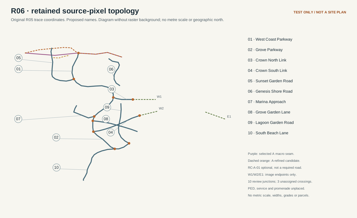
| Regional source traces | Source pixels; original road traces, review junctions, boundary studies and POI identities. | Retain intent and review unresolved crossings. No source-pixel-to-metre fit is asserted. |
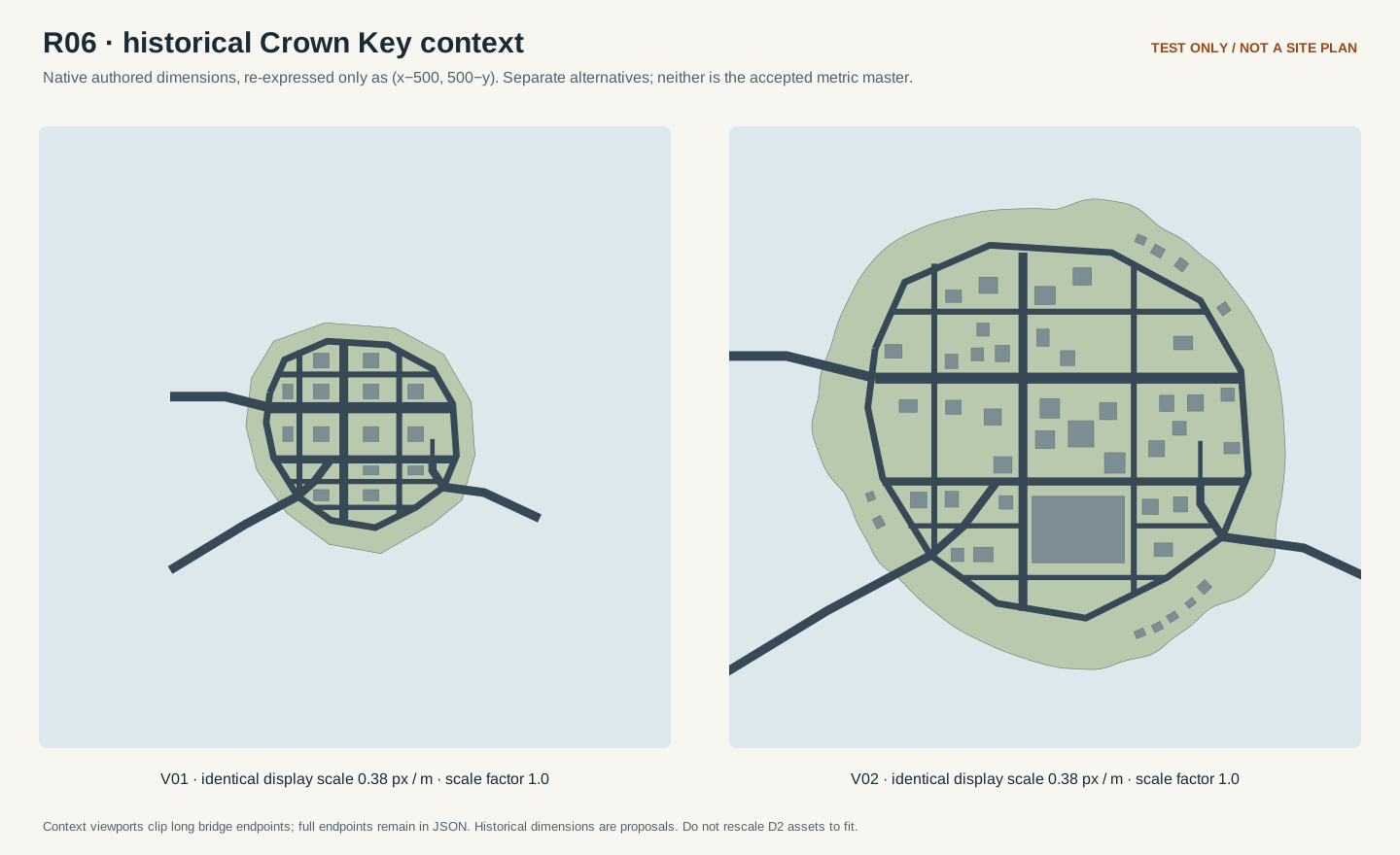
| Historical Crown Key alternatives | Native metre coordinates, scale 1 per revision, independently named v01/v02. | Compare source dimensions and controls. Preserve existing asset dimensions; choose an actual site transform separately. |
| Authored local connection specimen | Right-handed metres; explicit synthetic datum, two shores, approaches, deck and pedestrian folds. | Validate/import in isolation. The local centimetre adapter does not provide world placement. |
The local axis adapter is an explicit staging convention. It is not a registered world placement. Apply a unit/axis conversion once, preserve mesh winding when reflecting axes, and record the actual importer roundtrip before reporting an engine pass.
See what the numbers describe
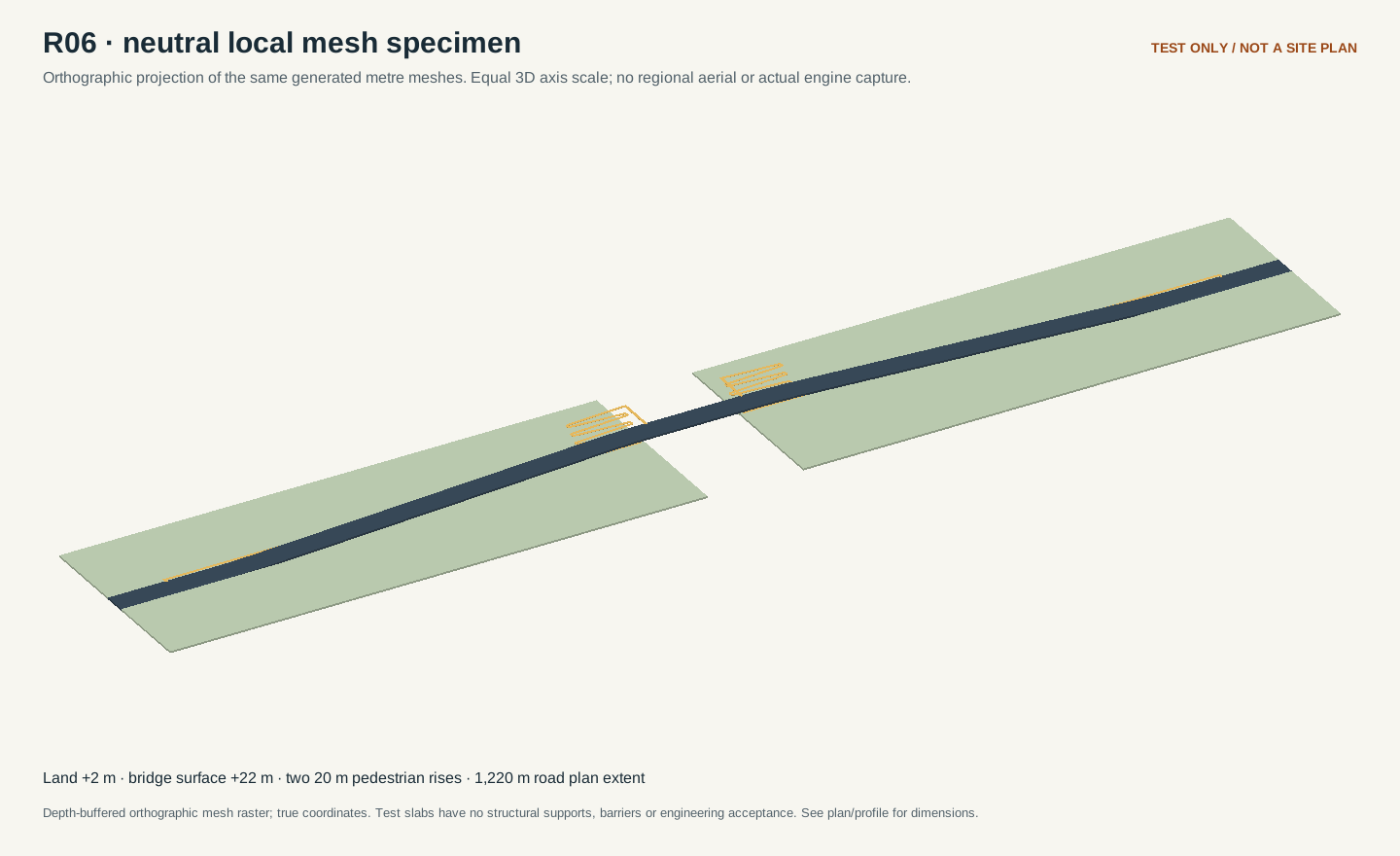
These previews are drawn from the published geometry. The metric specimen is a synthetic connection study; the separate pixel and historical layers are not presented as a registered Southwest aerial.
test specimen
Clean metric plan
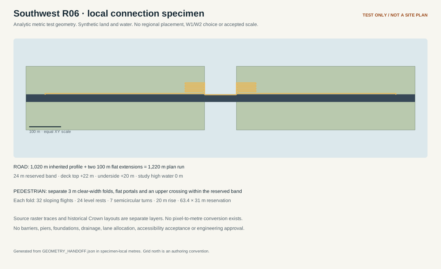
test specimen
Labelled metric plan
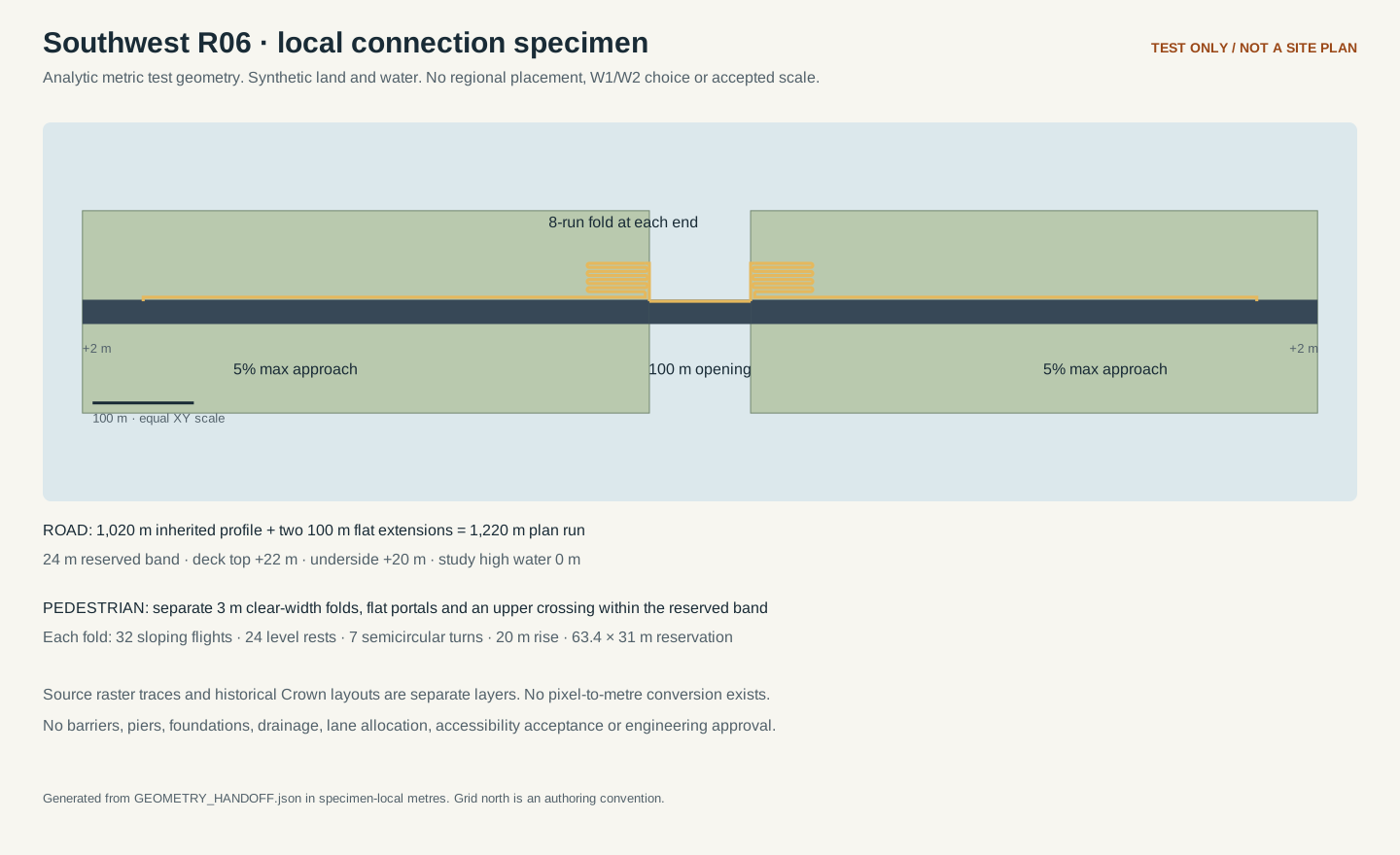
test specimen
Road profile and clearance
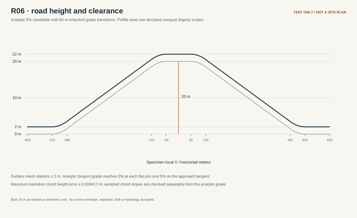
test specimen
Pedestrian fold detail
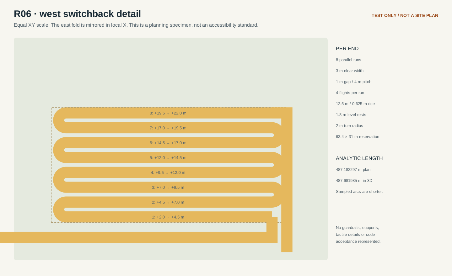
test specimen
Neutral mesh view
source pixels
Retained pixel traces
historical native
Native Crown context
What was checked
| Check | Result | Evidence / limit |
|---|---|---|
| Independent source and formula audit | pass · 65 checks | Native dimensions, source hashes, grades, clearance and exact versus sampled path lengths. |
| Independent exported-geometry audit | pass · 541 checks | Actual mesh faces, navigation prism, fold boundaries, portals, source/native preservation and negative probes. |
| Package geometry validator | pass | 11 closed test meshes; exact approach/deck seams; finite coordinates and source/artifact hashes. |
| Regional street topology | review required | 3 source crossings retain unknown connectivity/grade; proposed names stay proposed. |
| Blender / Unreal execution | not_tested | Portable import preflight and point-axis checks are data tests. Actual importer roundtrip, normals, collisions and navigation require Quik’s environment. |
| Regional construction / online capacity | unaccepted / not_tested | Regional size, shared datum, placement, engineering and runtime capacity remain separate gates. |
Correct arithmetic and valid exported geometry do not establish structural, accessibility, collision, navigation, boat-sweep or Unreal acceptance. The same regional model-and-camera aerial set remains a later production gate.
From review to region construction
- Run the supplied preflight, then import the metric specimen into an isolated test collection. Return measured axis-control distances, bounds, winding/normals and the actual importer/version evidence.
- Select the shared regional metric frame, final scale, north convention and water datum. Register actual Crown Key and coast source controls with a rigid transform that preserves native asset scale.
- Author the connected regional coastline, road and bridge layout; review the unassigned street crossings, proposed names, grades and bridge approaches together.
- Review program zones, parcels, building envelopes and public/service routes with Legend and Quik. District 3’s existing geography pause remains in force until its replacement inputs are approved.
- Save overhead, orbit and ground cameras in the same reviewed model revision; capture matching clean views and separate label overlays. Record actual Unreal and multiplayer tests as their own evidence.
Source baseline: bfef0a6bc2f33e28ac5d07e84e51cf86687c3b7d
Repository: R06 source and audit evidence · Publication PR #100