Crown Key West Approach
The three image sets show the same Crown Key: same skyline, same marina edge, same east bridge. They disagree about the west side, which is the side that touches the West Coast. Each set lands the west bridges in a different place.
Summary
The West Coast overview lines up with the Crown Key references on the spiral tower, A-frame tower and X-braced tower. The east bridge lands in the same spot in both.
The references and the v02 plan land it at the southwest corner by the pool hotel, about 600 m south of the first. The overview puts it right beside the first, about 250 m apart.
One road bridge at the pool hotel, which matches the references, plus a pedestrian bridge further south that no Crown Key image has. No northwest bridge in view.
All three, traced on one frame
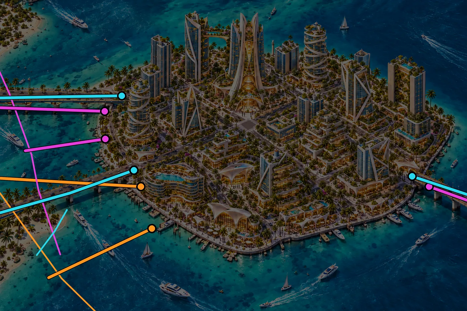
Where each set puts the bridges
| Image set | West bridges | West landings apart | East bridge | Notes |
|---|---|---|---|---|
Crown Key references + v02 plan | 2 road: NW corner by the spiral tower, SW corner by the pool hotel | ≈ 600 m | Yes | The plan and the references agree. Plan mainland ends are 940 m apart. |
West Coast overview | 2 road, side by side, both at the spiral tower | ≈ 250 m | Yes, same spot | Nothing lands at the SW corner. The Grove shore sits close across a narrow channel. |
Grove 2043 aerials | 1 road at the pool hotel, 1 pedestrian further south | ≈ 200 m | Not in view | Source for Quik's current build (main bridge + Helix pedestrian). No NW bridge in view. |
Distances use the v02 plan's scale, carried through the reference image. They're rough and only meaningful on the island itself. They are for comparing the sets, not for building to.
Crown Key references vs West Coast overview
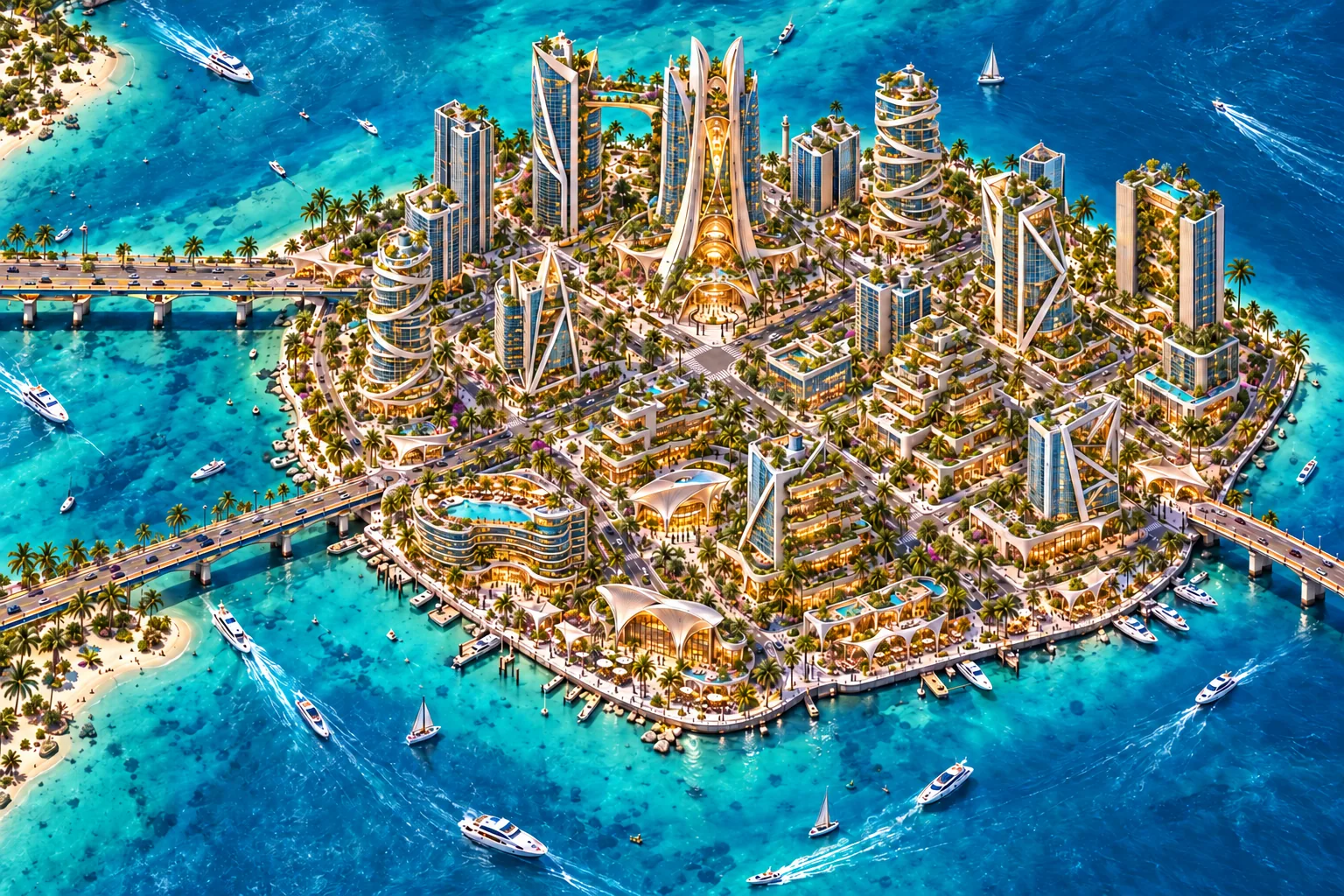
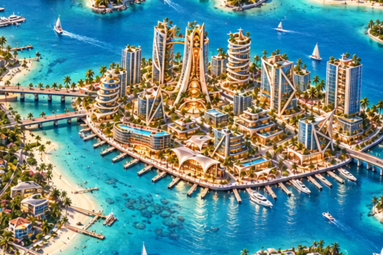
Slide between them. The towers and the south marina edge hold steady. On the left, the overview's second bridge fades in halfway between the reference's two west bridges. The overview's Grove shoreline also runs straight down the left edge, so both of its west bridges are short.
Crown Key references vs Grove aerial (west shore)
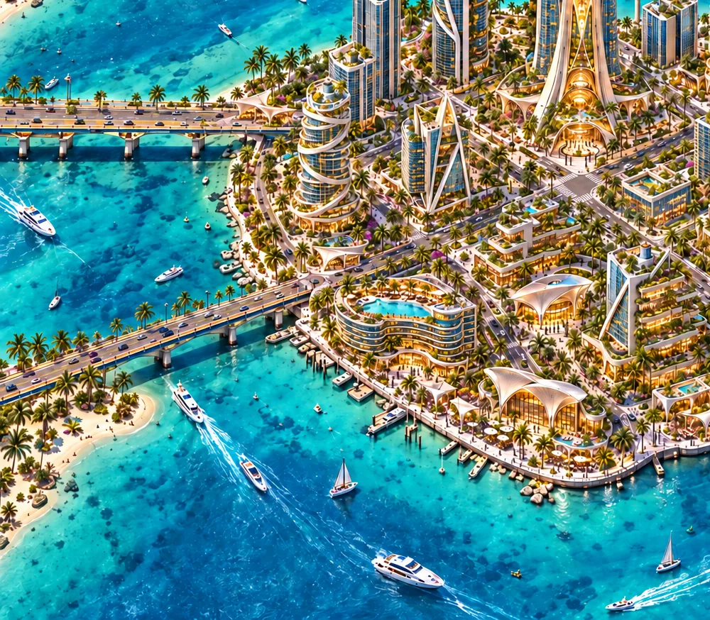
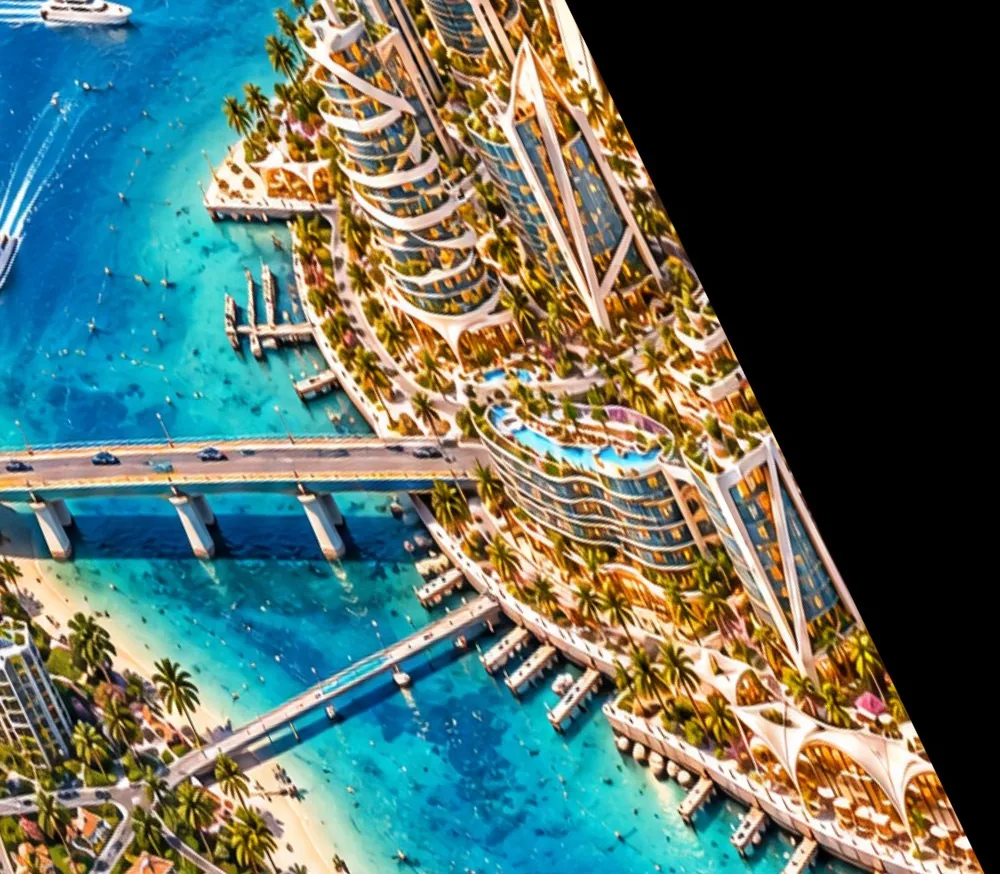
The Grove aerial looks at Crown Key from a lower, more westerly angle, so only the west shore lines up. The aerial's road bridge lands at the pool hotel, where the reference's southwest bridge lands. Its pedestrian bridge comes in south of that, near the marina.
The v02 plan laid over both
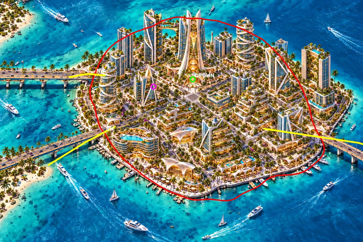
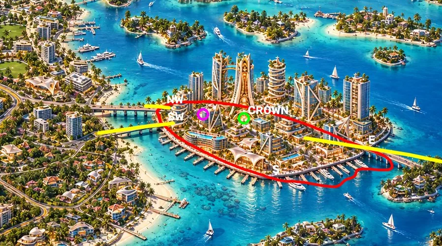
What needs deciding
One west-side arrangement has to become the rule. Then the other images get redone to match before Quik gets a frame. Legend decides; this is tracked as PI-007 in the island issue register.
- Road bridges. Claude's recommendation is the Crown Key arrangement: northwest and southwest corners, with the east bridge as is. The plan, the 14 references, the Crown Key hub and the building kits already use it. The overview already agrees on the northwest and east bridges, so only its second west bridge moves south to the pool-hotel corner.
- Pedestrian bridge. Legend's switchback decision exists, but only the Grove aerials show a pedestrian bridge, and no Crown Key image does. If it stays, it needs a spot on the plan and a place in the master image. If it goes, the switchback decision should be retired.
- Channel width. The plan's west bridges run 400 to 700 m to the mainland. The images show a much narrower channel. That's a scale question for Quik's measurements, not something these images can settle.
- Grove aerials. Once the master is fixed, these become history. They're the outlier and the source of the out-of-spec build.
How this was made
- The overview was aligned to the reference on six shared tower bases (rotation, scale and shift only). Most bases land within 20 to 30 px. The crown spire is about 110 px off, so the two skylines aren't identical.
- The Grove aerial shares only three usable bases with the reference, so its fit is exact by construction. It holds near the west shore and drifts further away from it.
- Metres come from pinning the v02 plan to the reference at three bridge landings and the south tip, then carrying the other sets' landings through that. Bridge lengths and channel widths aren't given, because the projection breaks down away from the island.
- The twilight overview has the same composition as the daytime one and wasn't traced separately.
- All of these are generated images. They show intent and disagreements. They don't set scale.
- Control points, traces and the method are recorded in
production/regions/WestCoast/reviews/2026-10-15-crown-key-west-approach/. - Sources:
production/districts/D02-CrownKey/references/37, the West Coast intake oncodex/west-coast-intake-20261015, anddata/districts/brickell_layout_v02.jsononunreal-island-archipelago.